November 22, 2024 – by Santina Russo
In 2004, a 9.3-magnitude undersea earthquake occurred 160 kilometres off the coast of Sumatra. The resulting tsunami killed 230,000 people and displaced another three million. In addition to the catastrophic loss of human life, economic damage was severe. In Sri Lanka, 75 percent of the fishing industry was wiped out. In Thailand, key tourist regions were devastated, and port industrial facilities were destroyed. The tsunami also polluted freshwater wells and agricultural land with salt, rendering entire areas infertile. In 2011, another earthquake-triggered tsunami caused the Fukushima nuclear disaster.
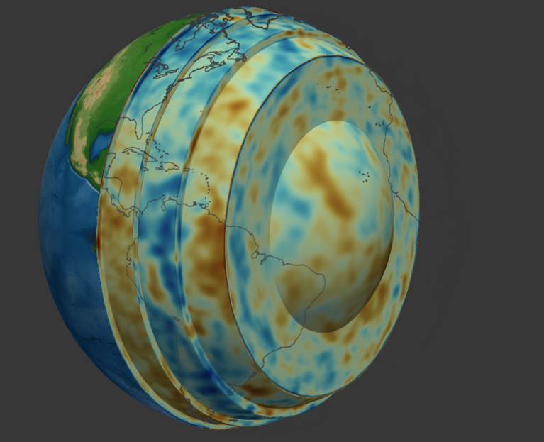
Although tsunamis of such magnitudes are rare, they are certain to occur again. The best defence for vulnerable coastal regions is to detect the danger as early as possible. This is why, with the support of CSCS computing resources, scientists at ETH Zürich have developed a model that helps assess the destructive potential of earthquakes and whether they will trigger a tsunami. This new model, named REVEAL, is the most precise representation of the Earth’s interior to date.
Models help us react to earthquakes
For some time now, seismic stations around the globe are used to detect earthquakes and collect seismic data. If the velocity of a seismic wave is known, scientists can pinpoint the location of an earthquake’s source and understand its propagation. However, “a seismic wave’s velocity changes depending on the type of material it is passing through in the Earth’s interior,” explains Andreas Fichtner, a professor at the Department of Earth and Planetary Sciences at ETH Zürich, frustrating efforts to accurately characterize earthquakes. This is where the REVEAL model, developed mainly by Sölvi Thrastarson, a former PhD student in Fichtner’s group, comes into play.
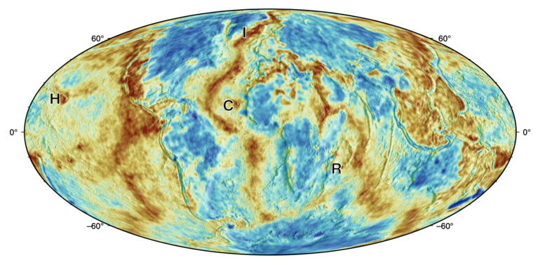
REVEAL essentially provides a three-dimensional map of seismic wave propagation within the Earth. “In simple terms, the model shows the solidity of the material in the Earth’s interior,” Fichtner explains. “For example, continents have a very high degree of rigidity. Some of them have not changed for hundreds of millions of years.” The model also reveals how tectonic plates shift, or how softer, hotter regions within the Earth’s interior move and influence surface events, such as large volcanic eruptions. “With REVEAL, these processes are visible in a level of detail not seen in models before,” says Fichtner.
Scientists can use the model to characterise an earthquake’s location, magnitude, and propagation pattern, which enables them to determine if populations are at risk. “The most important property to determine is the directional characteristic of an earthquake,” says Fichtner. An earthquake that can trigger a tsunami has a very specific directional characteristic. Other earthquakes with different characteristics might be large but still unable to trigger tsunamis. “We need to know these directions to estimate the impact of the earthquake.”
Building the most accurate model
REVEAL is built on millions of seismic measurements. “Such a seismogram has a very complex structure. Every wiggle in it has seen a different part of the Earth,” Fichtner explains. To extract all the information, the team needed to simulate every earthquake they wanted to include in the model using CSCS’s supercomputer “Piz Daint”. But the data from each earthquake only reveals a part of the Earth’s interior, and for every earthquake added, the computational costs rise.
To overcome these limitations, Fichtner’s team devised a way to include more earthquakes in the model without the usual increase in computational costs. “The thing with earthquakes is that a lot of them are rather similar,” notes Fichtner. Just including many seismic events without considering their similarity increases computational cost while potentially yielding little additional information. Fichtner’s group used this observation to develop a much more efficient method that cleverly exploits the redundancies in the earthquake data by applying machine learning principles.
Inspired by machine learning
Building on the team’s previously established model, LOWE, the new method autonomously identifies subsets of earthquakes from the entire dataset that will improve accuracy. With each iteration, the method checks how well the current model explained the data and automatically selects a new earthquake subset to include — one small enough to keep computer resources reasonable, but large enough to contain relevant information to improve the model.
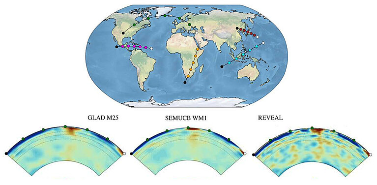
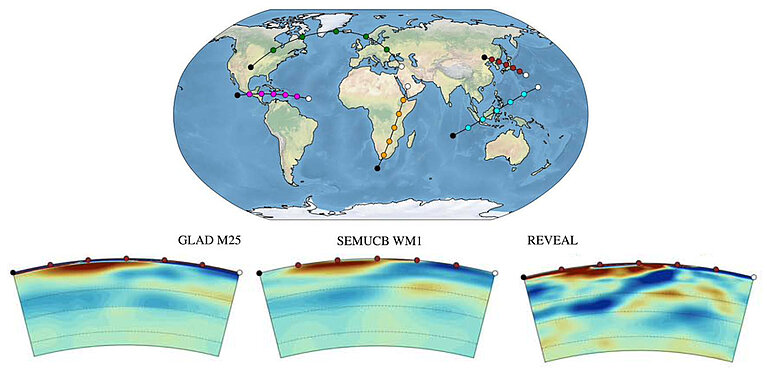
Thanks to the increased efficiency, REVEAL now incorporates data from more than 2,300 earthquakes — double the number of any other model. The team also reduced the minimum time period of included seismic waves from 100 to 33 seconds, which translates to a higher resolution model. To validate REVEAL, Fichtner’s team used it to predict the seismic waves of 25 earthquakes not included in the model’s development and found it determined their locations and directional characteristics more accurately than all previous models.
From nuclear tests to diamonds
Beyond predicting the impacts of earthquakes, such models can also support other applications such as the detection of nuclear tests, or to identify regions where precious mineral resources might have formed. For instance, REVEAL is already used by diamond exploration experts to investigate potential diamond formation sites.
Whether used to support resource exploration, reconstruct the Earth’s tectonic history, or analyse earthquakes, the model will continue to add new layers to our understanding of the planet’s inner workings.
REVEAL is openly accessible and can be downloaded from the group’s website.
Reference:
S. Thrastarson, D‐P. van Herwaarden, S. Noe, C.J. Schiller and A. Fichtner: REVEAL: A Global Full‐Waveform Inversion Model, Bulletin of the Seismological Society of America 114 (3): 1392–1406 (2024). DOI: https://doi.org/10.1785/0120230273


